The primary objective of this project is to establish a High Frequency (HF) operational service for real-time specification (now-casting) and short-term forecasting of the state of the ionosphere over the eastern Mediterranean region. This real-time service will be based on ionosonde measurements from Cyprus and will involve the application of existing modelling techniques and the development of mathematical methods and visualisation tools for the forecasting and regional mapping of ionospheric characteristics and provision of associated warning information to enhance HF communication systems operating in the region. The forecasts generated by this HF operational service will also involve the use of additional space weather data sources that have become available through the space weather community. The forecasts will be linked directly to HF sky-wave prediction programmes so that HF frequency managers and users will benefit from near real-time updates of environmental conditions as they develop. This will enable the users to adapt to periods of adverse propagation conditions.
The incentive for this initiative stems out of the well-known fact that the day-to-day variability of the critical frequencies (foF2) is unpredictable, with significant variability (>20%) about the monthly median and even greater variability (>40%) during ionospheric storms. This directly affects HF communications by altering the Maximum Usable Frequency (MUF). For HF skywave operators’ frequency schedules are very important, and are planned several months in advance.
This ionospheric operational service is expected to complement the operation of a recently deployed HF spectral interference monitoring system in Cyprus and enhance its functionality in the frames of real-time monitoring of regional HF propagation conditions to advise operators on typical interference occupancy levels, and assist in the planning of frequency usage and management. The operation of the proposed forecasting service is considered quite beneficial in the case of Cyprus (especially in the context of defence communication systems) where the so-called near vertical incidence sky-wave (NVIS) mode of propagation is the preferred mode of HF communication networks due to terrain imposed limitations.
- Pezzopane, B. Zolesi, M. Pietrella, H. Haralambous, C. Oikonomou, Lj. R. Cander Ionospheric Prediction and Forecasting Services in Mediterranean Area, European Geosciences Union General Assembly (EGU2014) Vienna April 2014.
- Haralambous, C. Oikonomou,M. Pezzopane, B. Zolesi, M. Pietrella, Lj. R. Cander Assimilation of Real Time Data into Local Ionospheric Prediction and Forecasting Mediterranean Model, Committee on space research Scientific Assembly COSPAR 2014 Moscow August 2014.
- H Haralambous, C. Oikonomou, M. Pezzopane, B. Zolesi, M. Pietrella, L. R. Cander Validation of the Cyprus Ionospheric Forecasting Service XXXI URSI General Assembly and Scientific Symposium of International Union of Radio Science August 2014 Beijing.
- Economou, H Haralambous, M. Pezzopane, B. Zolesi, M. Pietrella, L. R. Cander, Validation of the Cyprus Ionospheric Forecasting Service during disturbed geomagnetic conditions 11th European Space Weather Week (ESWW11) November 2014 Liege.
- Garcia-Rigo, A.; Roma, D.; Hernandez, M.; Li, Z.; Terkildsen, M.; Ghoddousi-Fard, R.; Dettmering, D.; Erdogan, E.; Haralambous, H. et. al, IAG’s real time ionosphere monitoring working group: current status, outcomes and first results IAG Commission 4 Positioning and Applications Symposium September 5, 2016, Wroclaw, Poland.
- Alberto García-Rigo and the Real Time Ionosphere Monitoring Working Group (RTIM-WG) Patrick’s Day 2015 geomagnetic storm analysis based on Real Time Ionosphere Monitoring, European Geosciences Union General Assembly (EGU2017) Vienna April 2017.
The project consists of 6 work packages:
- WP1. Project management
- WP2. Dissemination and exploitation of results
- WP3. Monitoring and data collection
- WP4. Ionospheric specification
- WP5. Integration of HF spectral occupancy measurements in CIFS
- WP6. CIFS validation
The Cyprus ionospheric forecasting service aims to initiate a novel service of added value to HF communication networks that can support critical functions like public information, humanitarian relief aid, disaster mitigation and military operations by exploiting the availability of current, complete, and accurate ionospheric information.
The primary scientific objective of the proposal is to establish an HF service to aid in the real-time estimation of potential circuit performance and in the operational frequency management of HF circuits. This will become possible through the application of now-casting and forecasting methods to map the state of the ionosphere over Cyprus and the eastern Mediterranean region and the provision of alerts and warnings for ionospheric disturbances providing users with predictions and meaningful estimates of the probability of HF system degradation.
The final output of this research is anticipated to enhance HF related services by studying and incorporating algorithms and models into a real – time framework to assist HF frequency planning over the eastern Mediterranean region.
Partners
-
Frederick Research Center

-
Ministry of Defence

-
Istituto Nazionale di Geofisica e Vulcanologia

-
Centre of applied sciences and technology

Researchers
- Dr. Haris Haralambous / Frederick Research Center
- Dr. Christina Oikonomou / Frederick Research Center
- Dr. Photos Vryonides / Frederick Research Center
- Dr Eleni Tsolaki / Frederick Research Center
- Dr. Harris Papadopoulos / Frederick Research Center
- Dr Ljiljana R. Cander / Rutherford Appleton Laboratory
- Dr. Bruno Zolesi / Istituto Nazionale di Geofisica e Vulcanologia
- Dr. Michael Pezzopane / Istituto Nazionale di Geofisica e Vulcanologia
- Dr. Marco Pietrella / Istituto Nazionale di Geofisica e Vulcanologia
- Dr. Silvia Pau / Istituto Nazionale di Geofisica e Vulcanologia
- Dr. Carlo Scotto / Istituto Nazionale di Geofisica e Vulcanologia
- Dr Lefteris Economou / Centre of Applied Research and Technology
- Dr. Andreas Konstantinidis / Frederick Research Center
- foF2 Nowcasting
- foF2 Long Term
- MUF Nowcasting
- MUF Long Term
- M3000F2 Nowcasting
- M3000F2 Long Term
- FPlot
Cyprus Ionospheric Forecasting Service (CIFS) Project
Frederick Research Center, Nicosia, Cyprus
Istituto Nazionale di Geofisica e Vulcanologia, Rome, Italy
Nowcasting map of the ionospheric characteristic foF2
Date: 25/09/2015 – Time: 12:00 UTC
Nowcasting map of the critical frequency foF2 over the East region of the Mediterranean area derived from the Simplified Ionospheric Regional UPdated Model (SIRMUP) with the autoscaled foF2 value taken from the ionospheric station at Nicosia (35.1�N, 33.2�E) at 12:00 UTC.
Ionospheric Characteristic: foF2
Reff: +034 – Date: 25/09/2015 – Time: 12:00 UTC
Cyprus Ionospheric Forecasting Service (CIFS) Project
Frederick Research Center, Nicosia, Cyprus
Istituto Nazionale di Geofisica e Vulcanologia, Rome, Italy
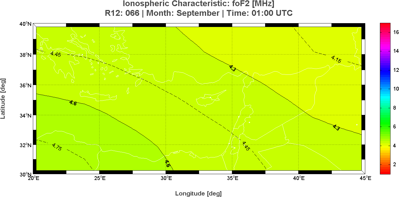
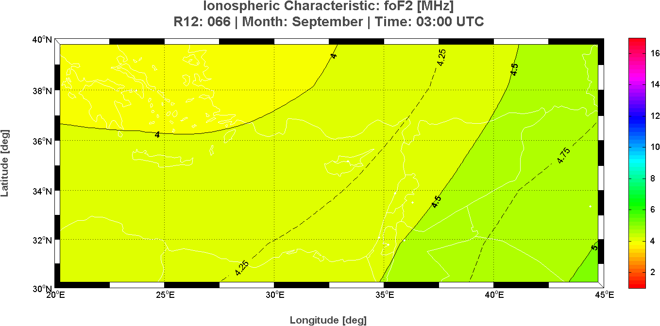
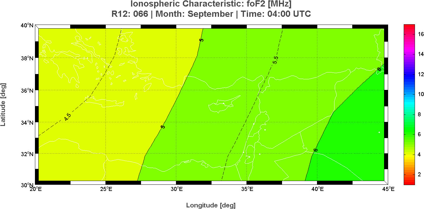
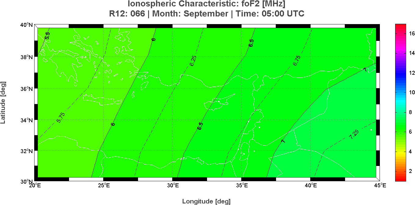
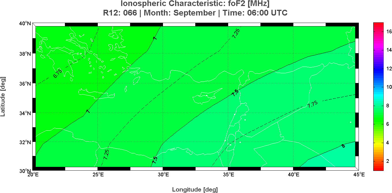
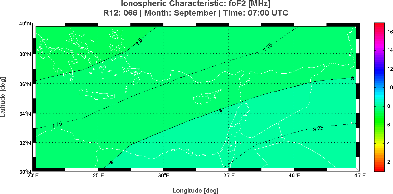
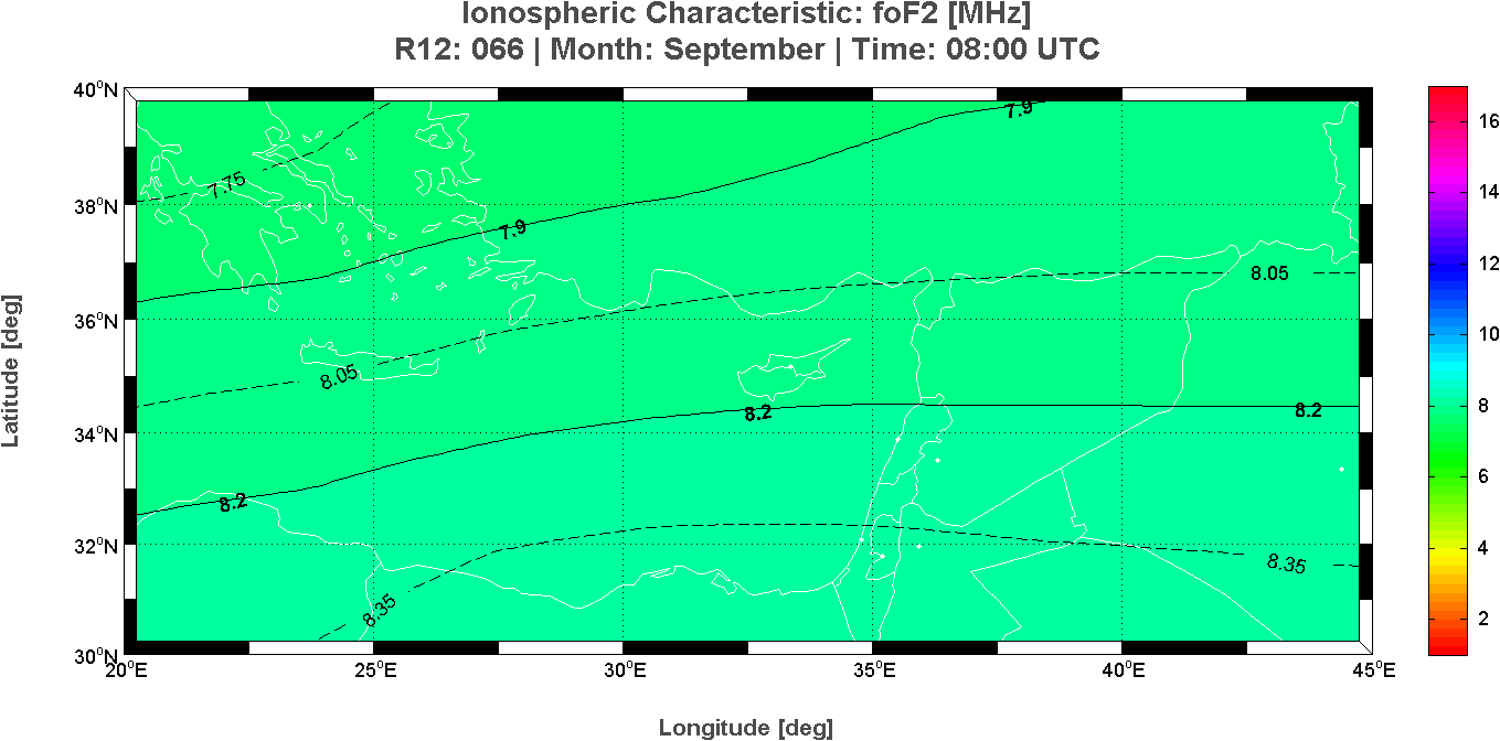
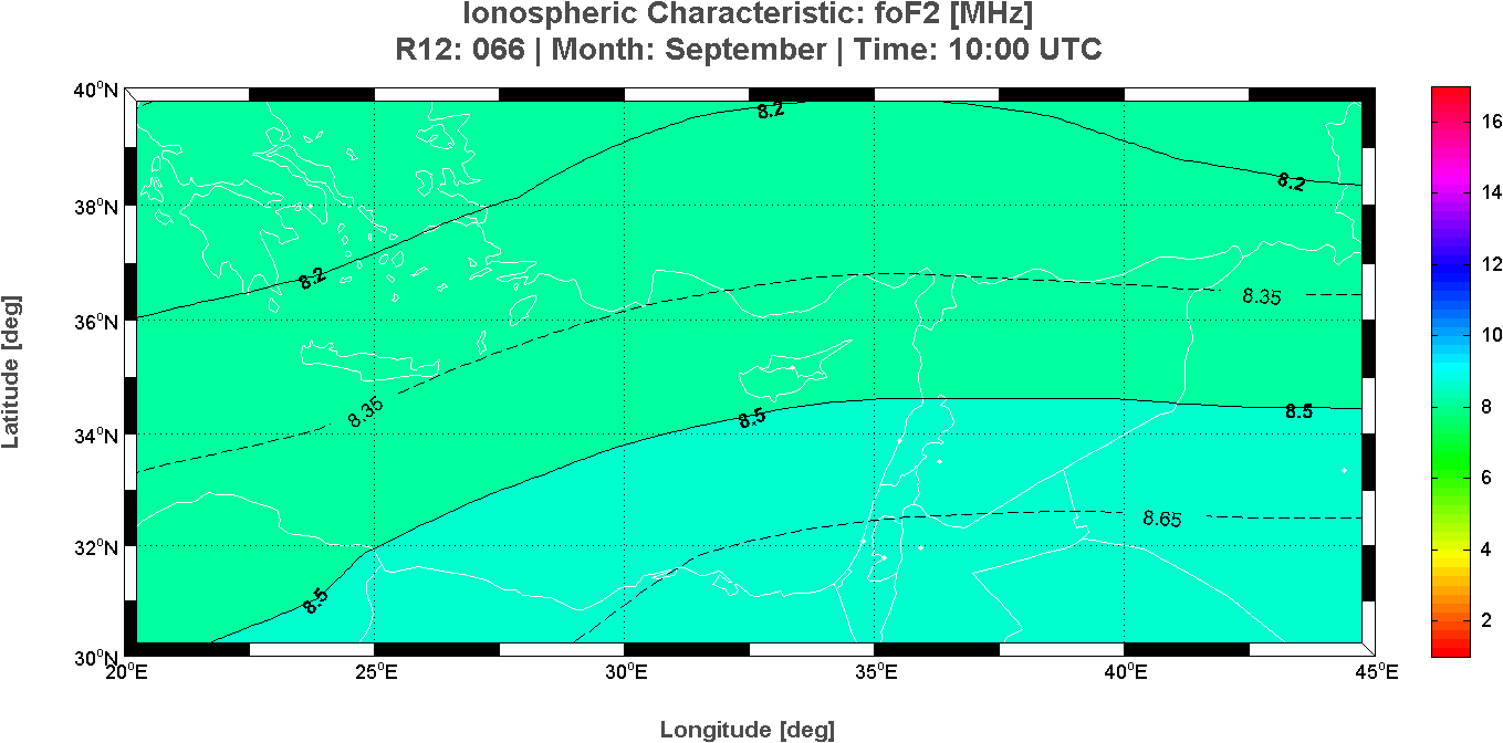
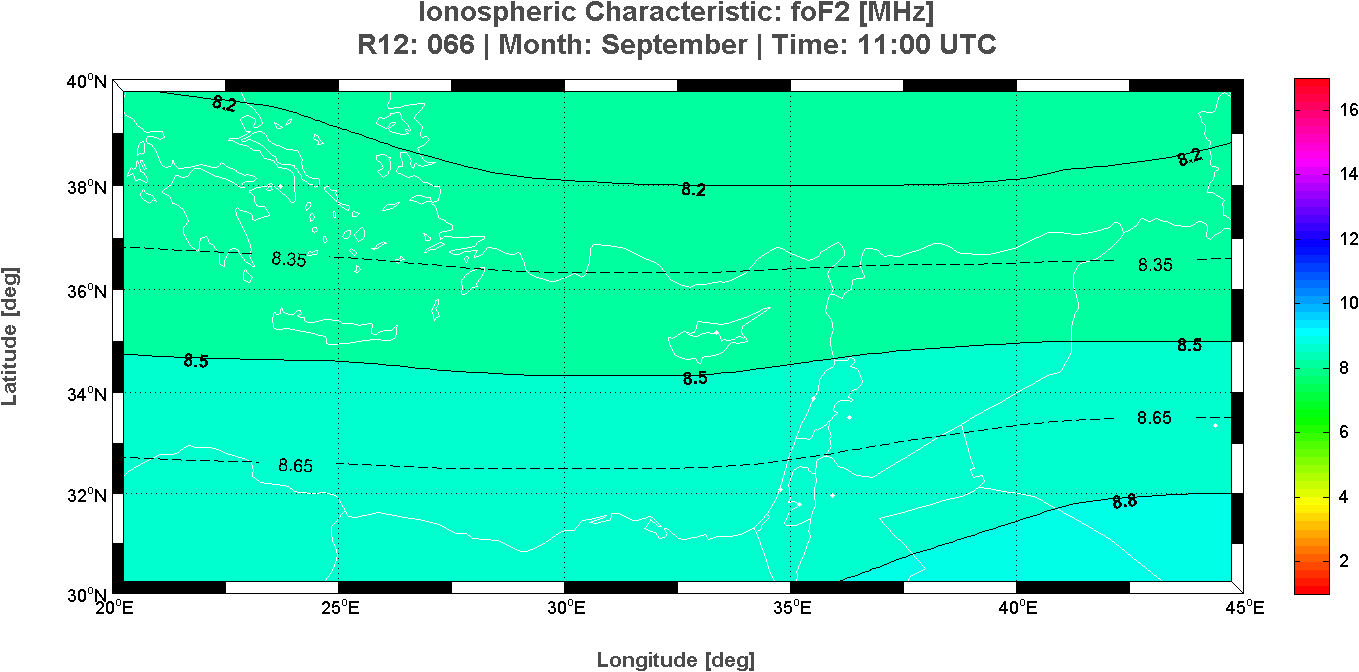
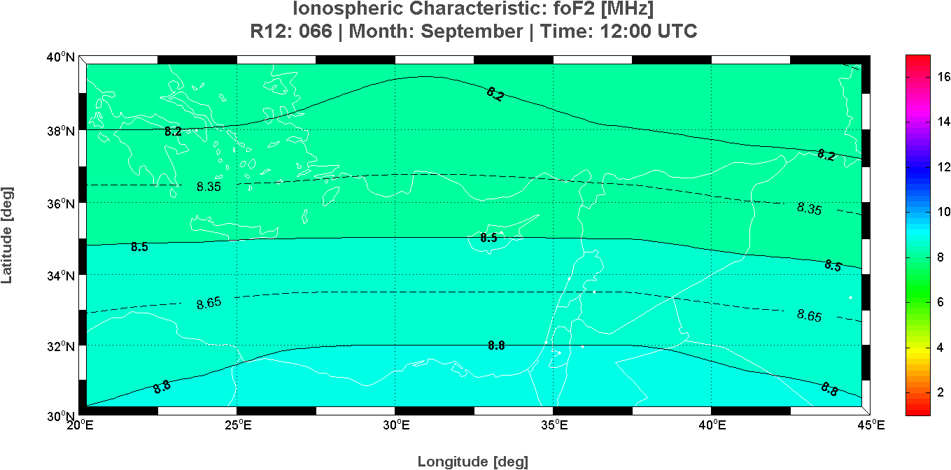
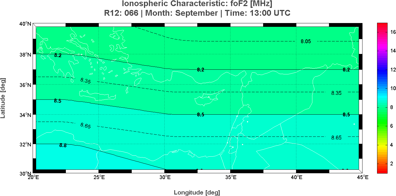
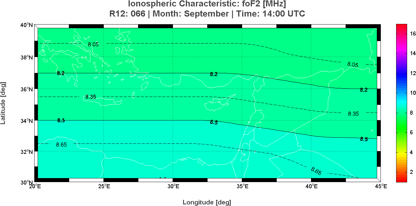
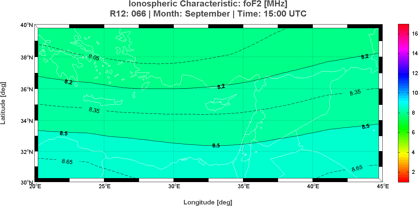
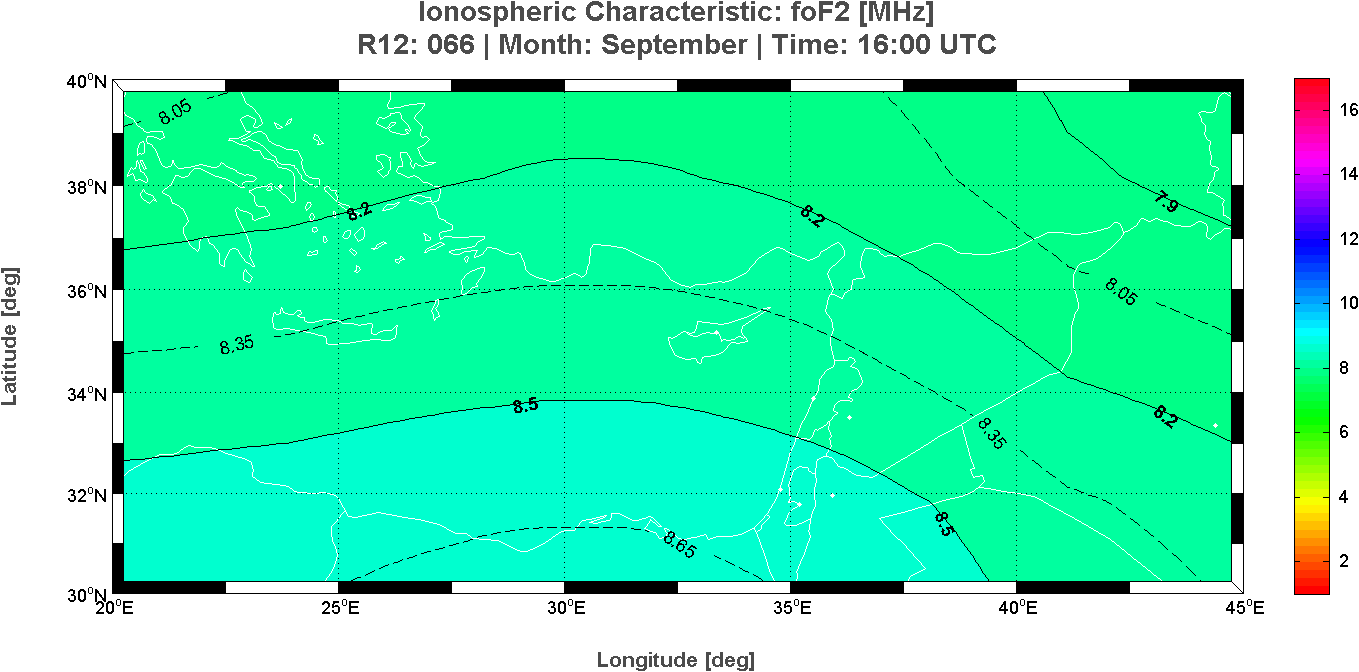
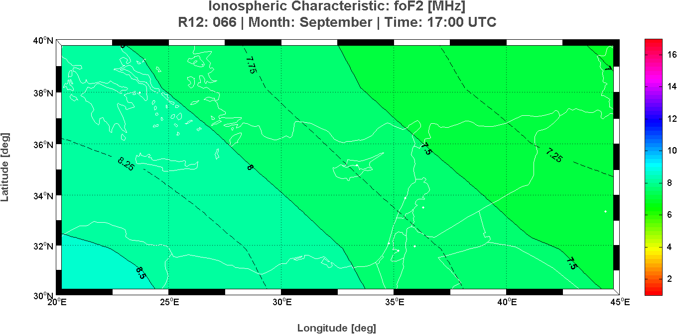
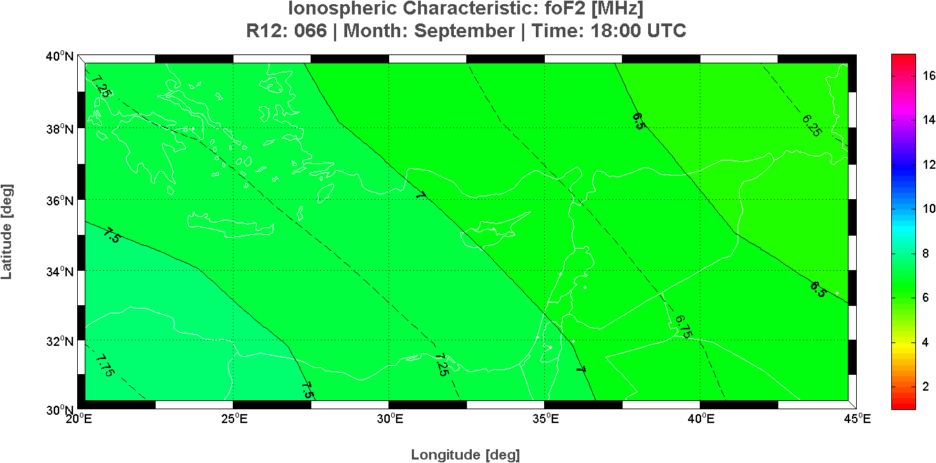
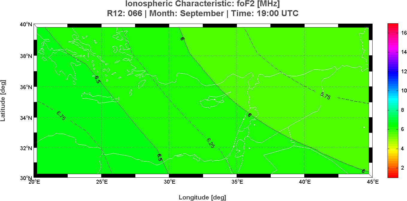
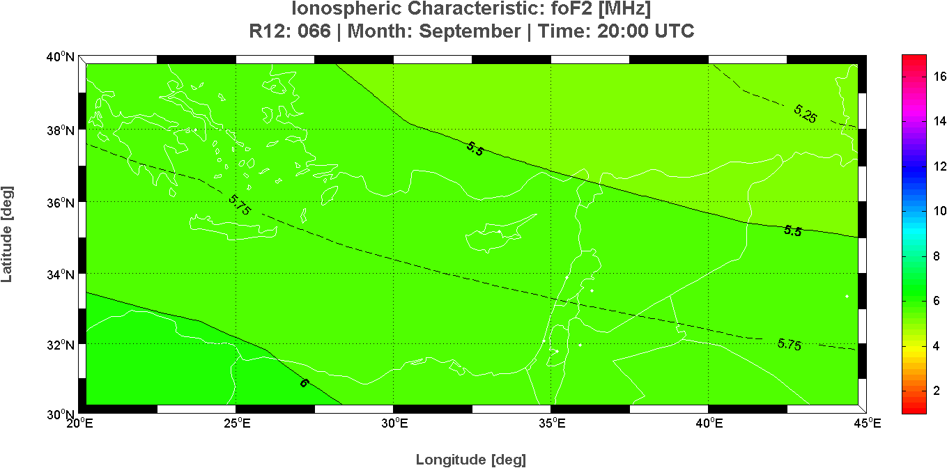
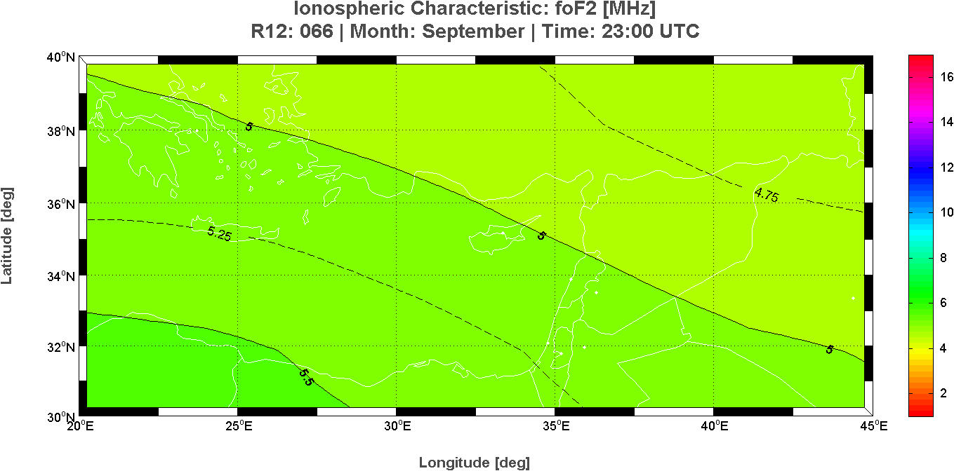
Long Term predictions maps of the ionospheric characteristic foF2
Month: September – Time: 24 hours
This page reports the 24 maps of the critical frequency foF2 calculated at each hour for the East region of the Mediterranean area. These long-term prediction maps of foF2 are derived from the Simplified Ionospheric Regional Model (SIRM).
 |
 |
 |
 |
 |
 |
 |
 |
 |
 |
 |
 |
 |
 |
 |
 |
 |
 |
 |
 |
 |
 |
 |
 |
Cyprus Ionospheric Forecasting Service (CIFS) Project
Frederick Research Center, Nicosia, Cyprus
Istituto Nazionale di Geofisica e Vulcanologia, Rome, Italy
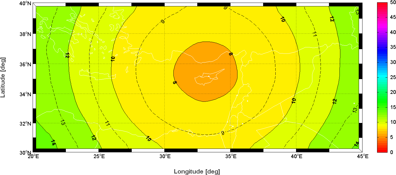
Nowcasting map of the Maximum Usable Frequency
Date: 25/09/2015 – Time: 12:00 UTC
Nowcasting map of the Maximum Usable Frequency over the East region of the Mediterranean area derived from the Simplified Ionospheric Regional UPdated Model (SIRMUP) with the autoscaled foF2 and M(3000)F2 values taken from the ionospheric station at Nicosia (35.1�N, 33.2�E) at 12:00 UTC.
Ionospheric Characteristic: Maximum Usable Frequency
Reff(foF2): +035 Reff(M3000F2): +015 – Date: 25/09/2015 – Time: 12:00 UTC
Cyprus Ionospheric Forecasting Service (CIFS) Project
Frederick Research Center, Nicosia, Cyprus
Istituto Nazionale di Geofisica e Vulcanologia, Rome, Italy
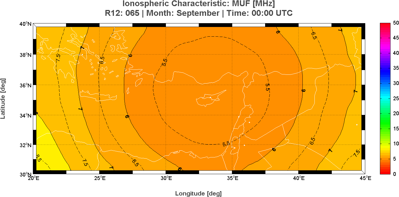
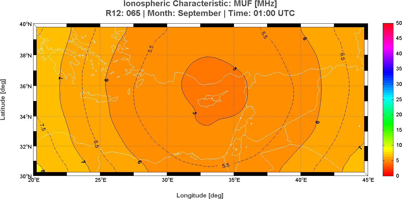
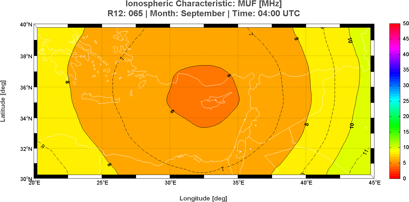
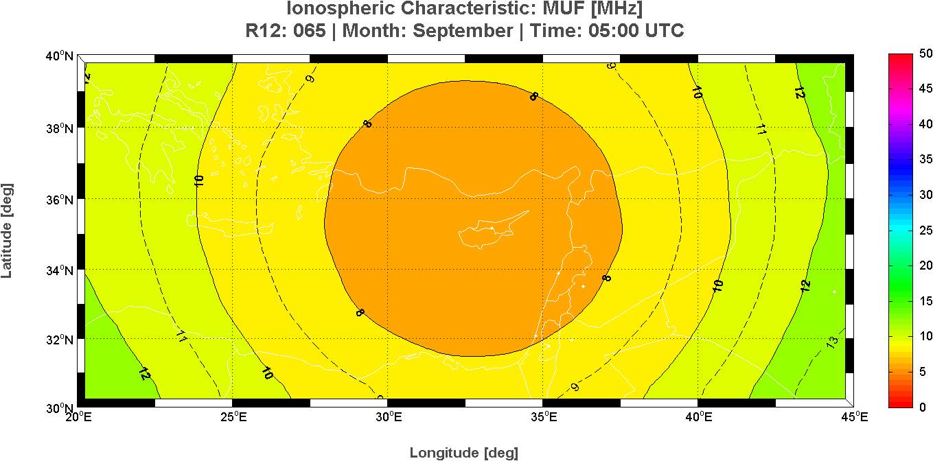
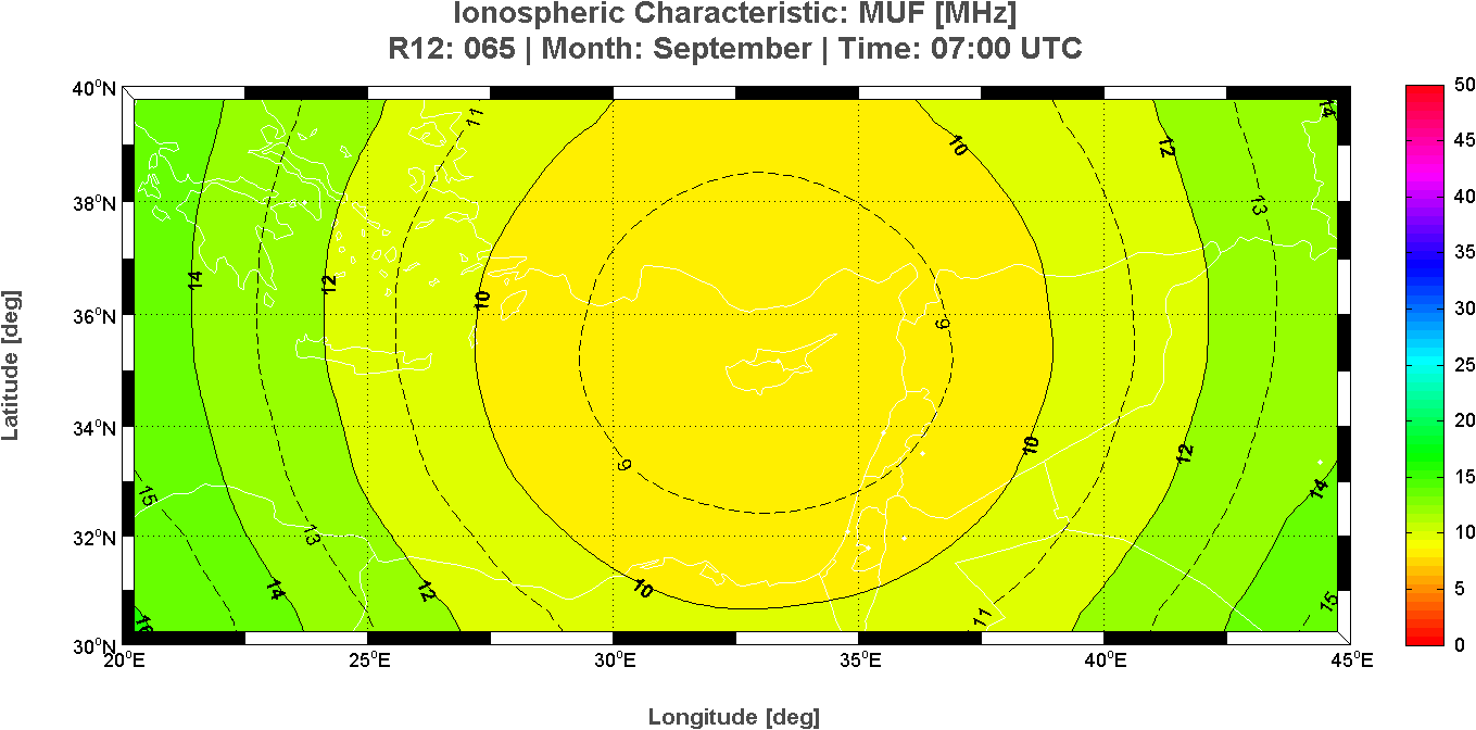
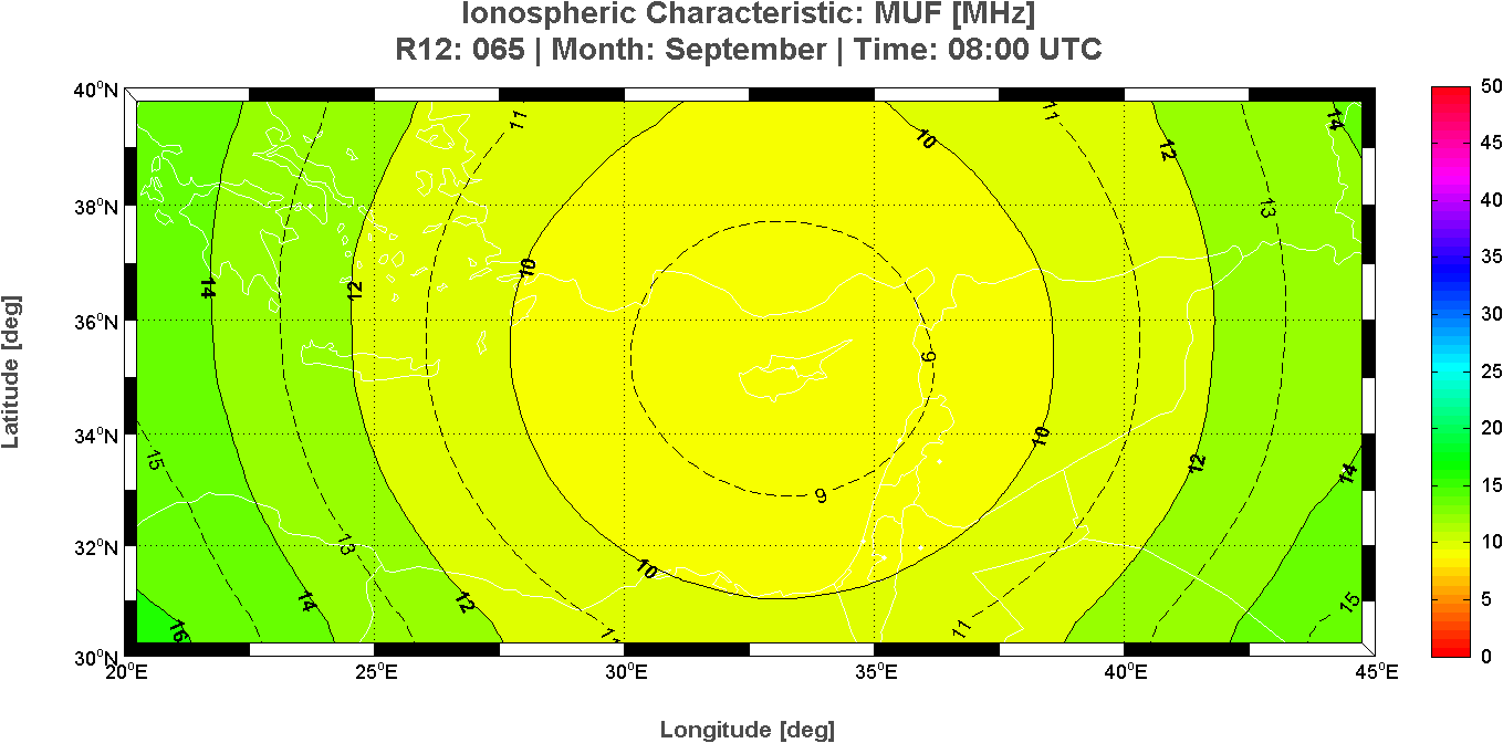
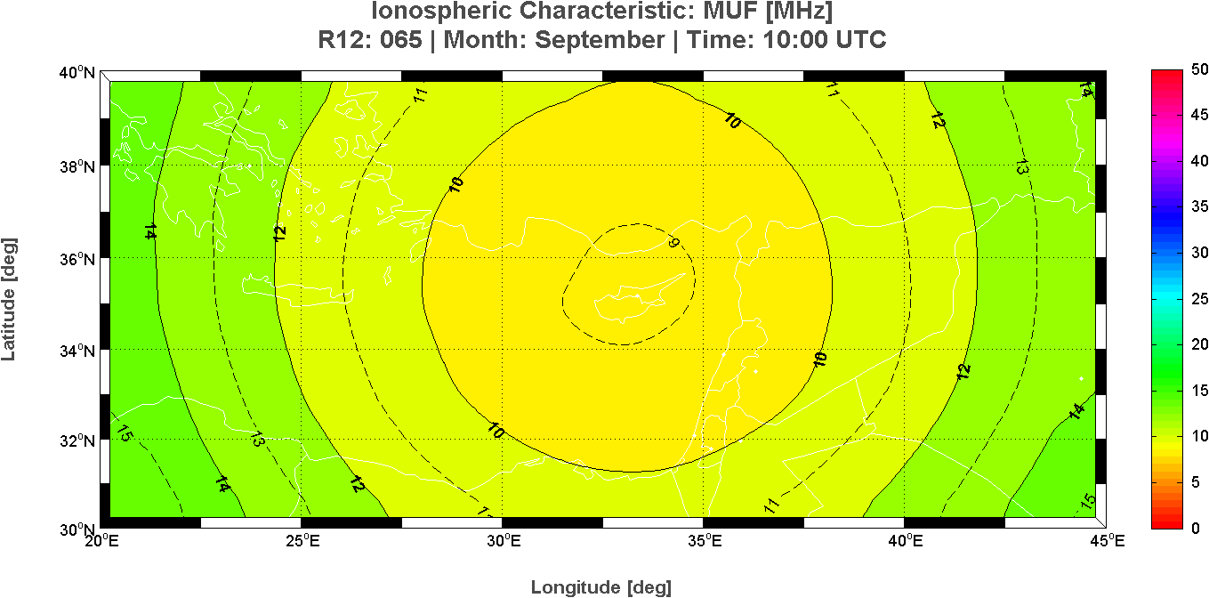
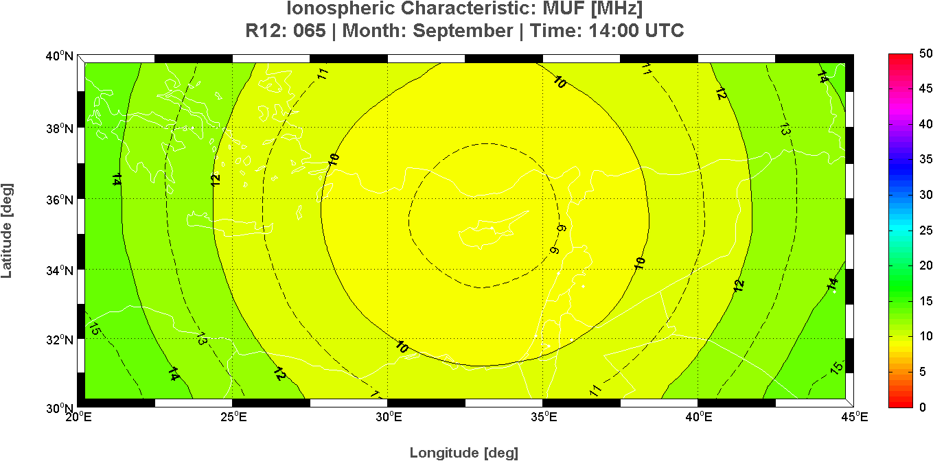
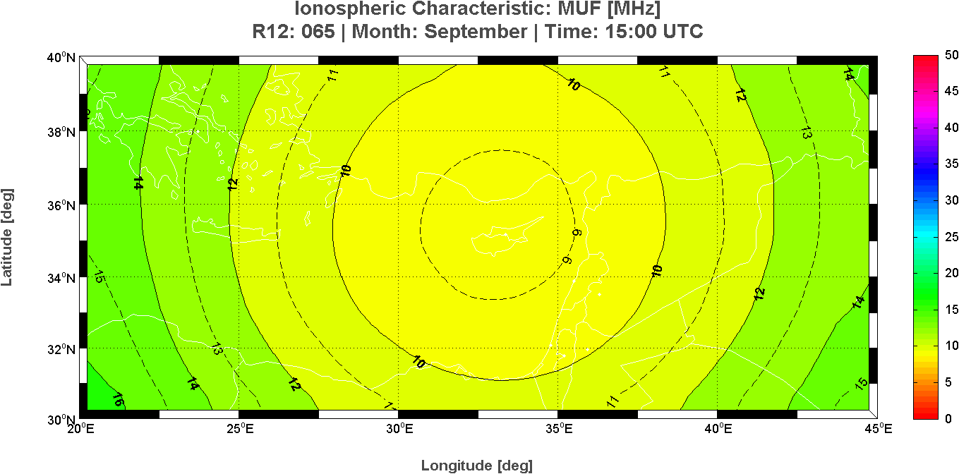
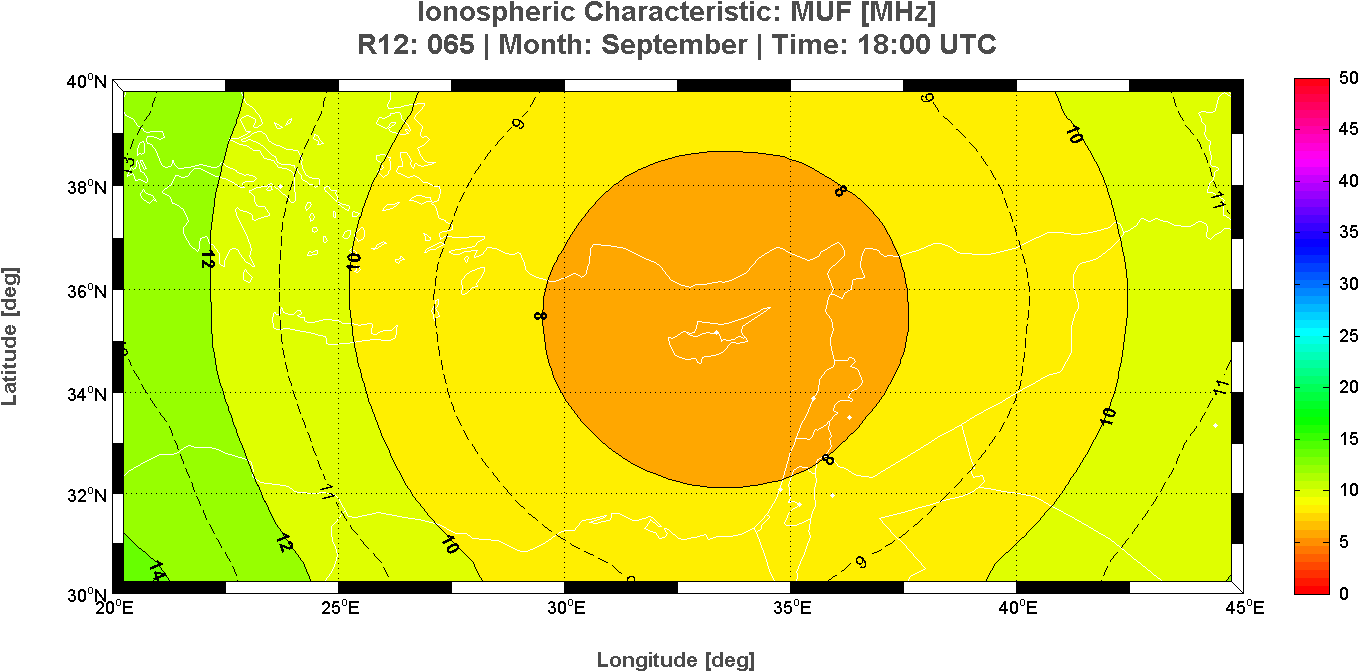
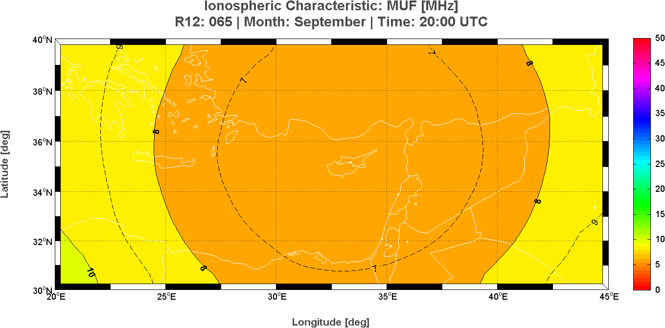
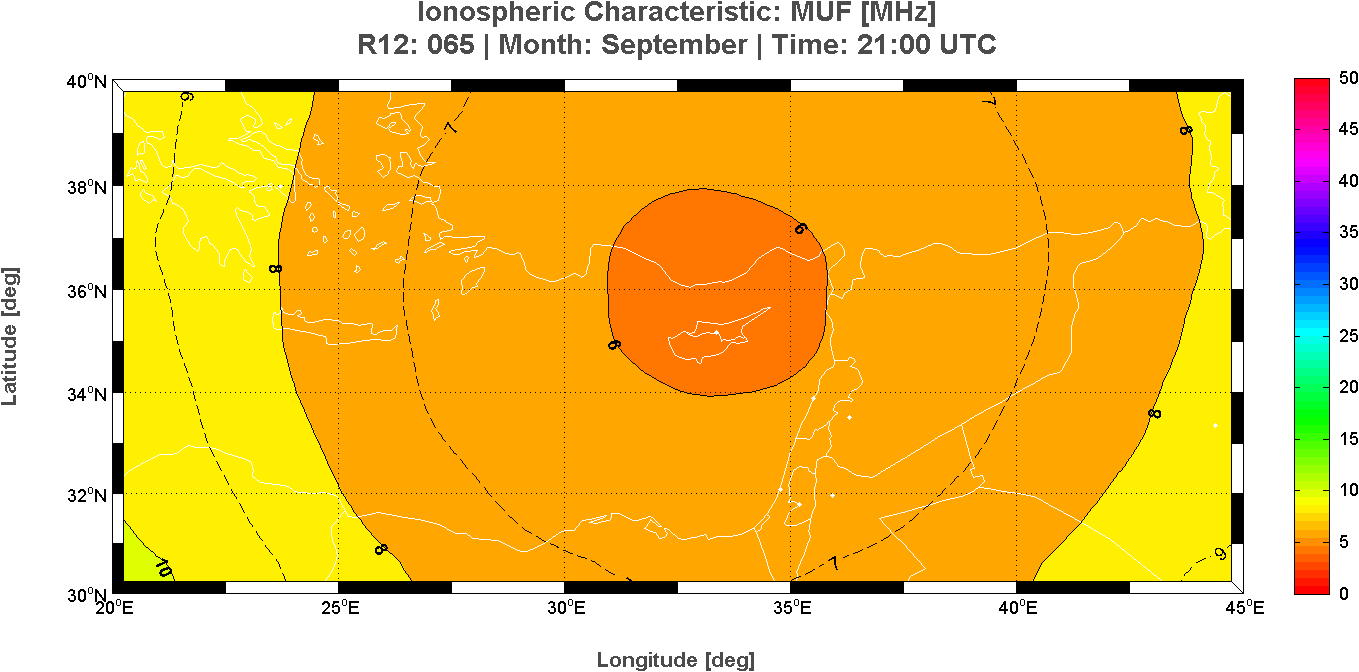
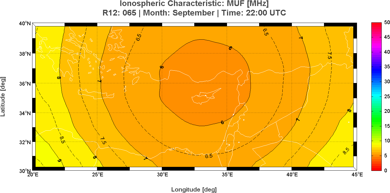
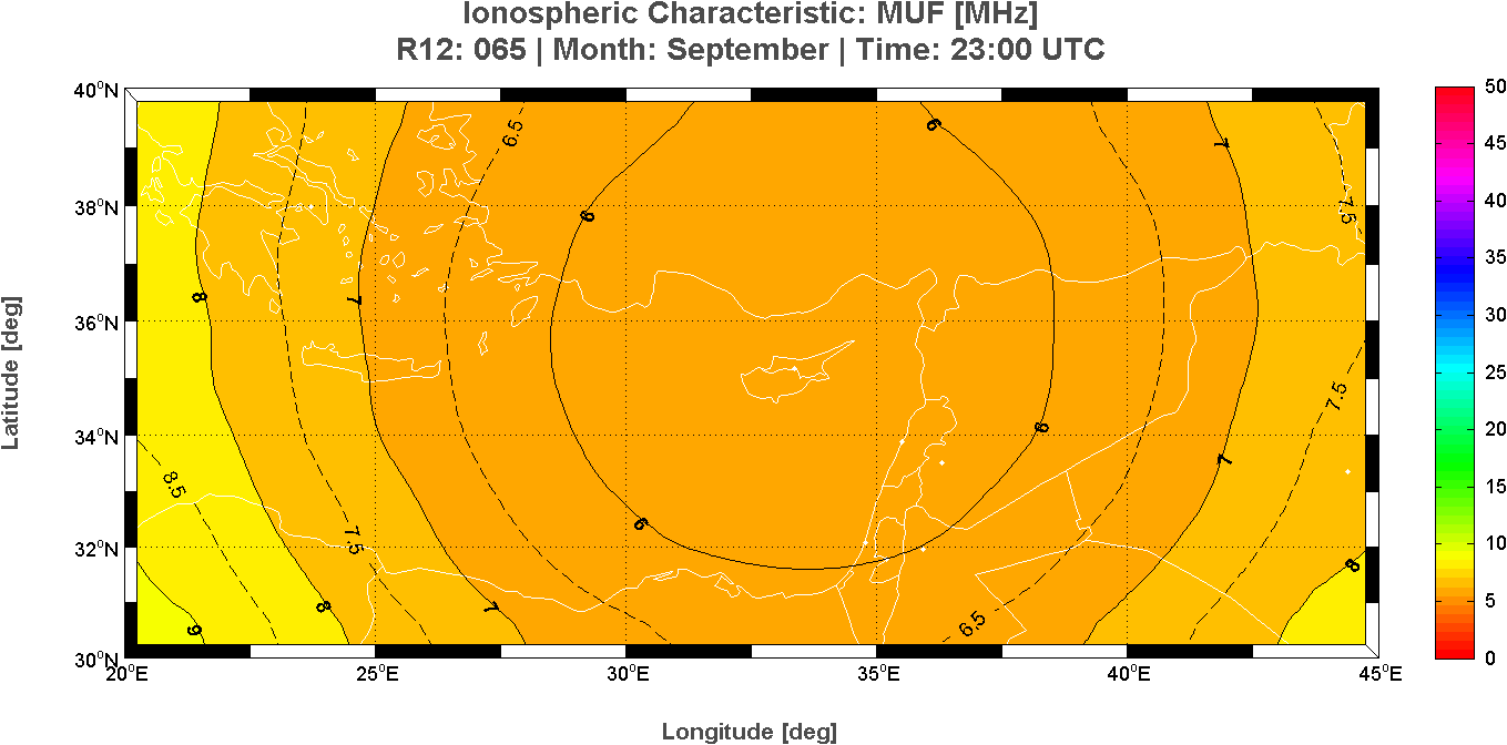
Long-Term predictions maps of the Maximum Usable Frequency (MUF)
Month: September – Time: 24 hours
This page reports the 24 maps of the the Maximum Usable Frequency (MUF) calculated at each hour for the East region of the Mediterranean area. These long-term prediction maps of MUF are derived from the Simplified Ionospheric Regional Model (SIRM).
 |
 |
 |
 |
 |
 |
 |
 |
 |
 |
 |
 |
 |
 |
 |
 |
 |
 |
 |
 |
 |
 |
 |
 |
Cyprus Ionospheric Forecasting Service (CIFS) Project
Frederick Research Center, Nicosia, Cyprus
Istituto Nazionale di Geofisica e Vulcanologia, Rome, Italy
Nowcasting map of the ionospheric characteristic M(3000)F2
Date: 25/09/2015 – Time: 12:00 UTC
Nowcasting map of the propagation factor M(3000)F2 over the East region of the Mediterranean area derived from the Simplified Ionospheric Regional UPdated Model (SIRMUP) with the autoscaled M(3000)F2 value taken from the ionospheric station at Nicosia (35.1�N, 33.2�E) at 12:00 UTC.
Ionospheric Characteristic: M(3000)F2
Reff: +015 – Date: 25/09/2015 – Time: 12:00 UTC
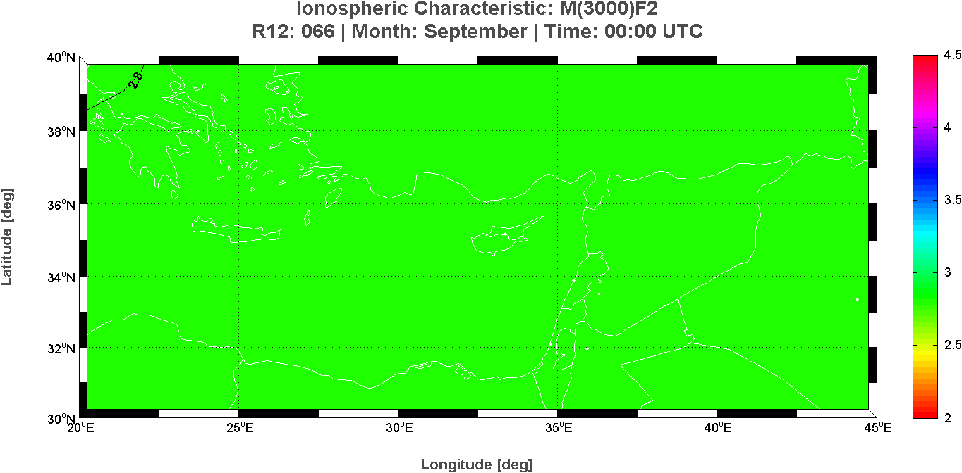
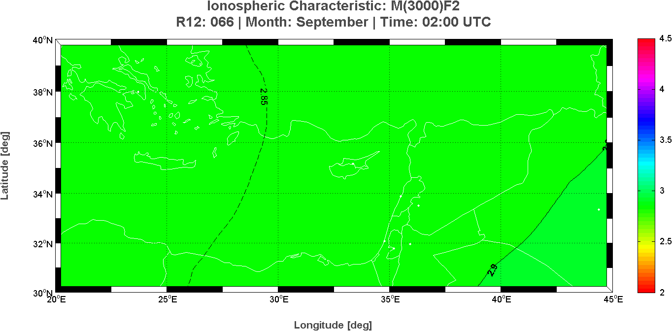
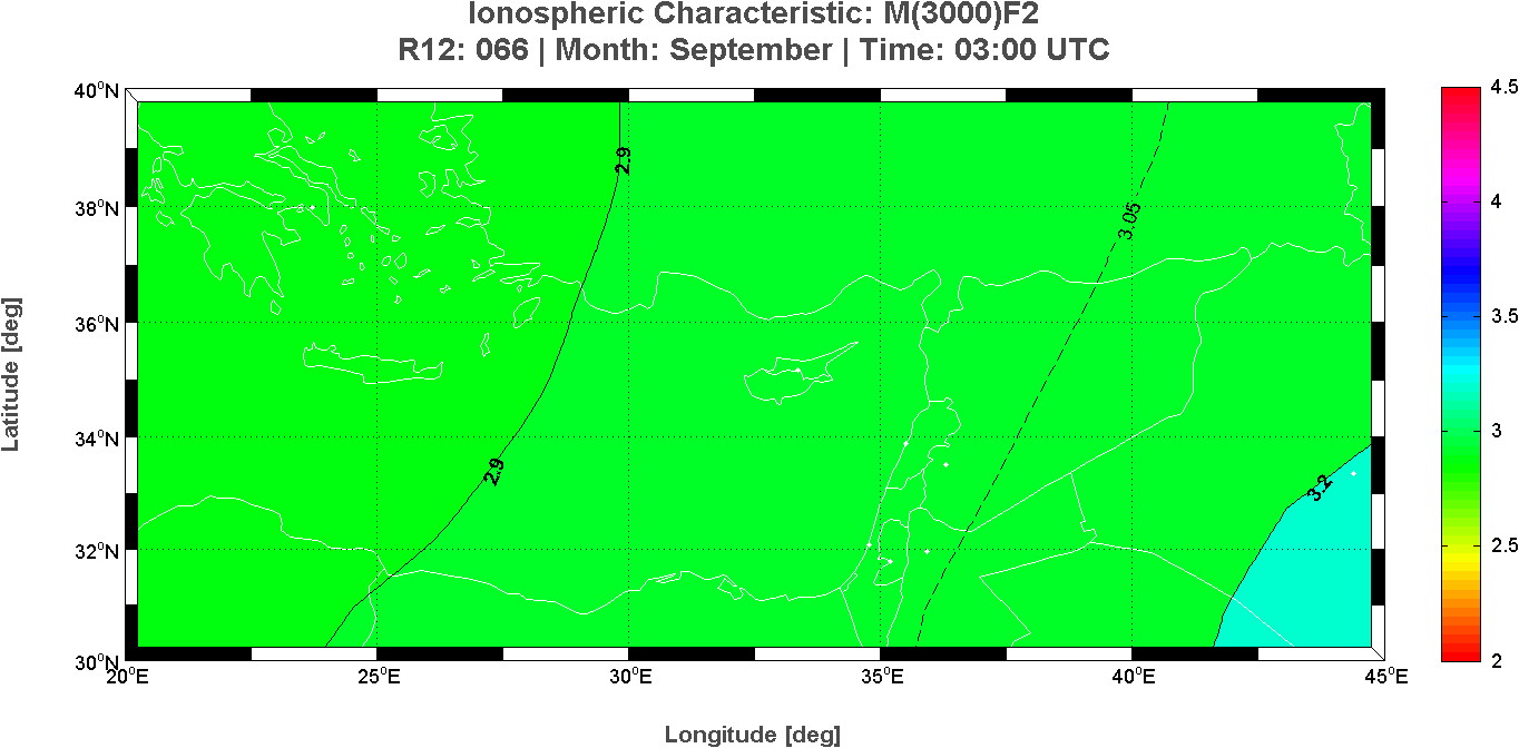
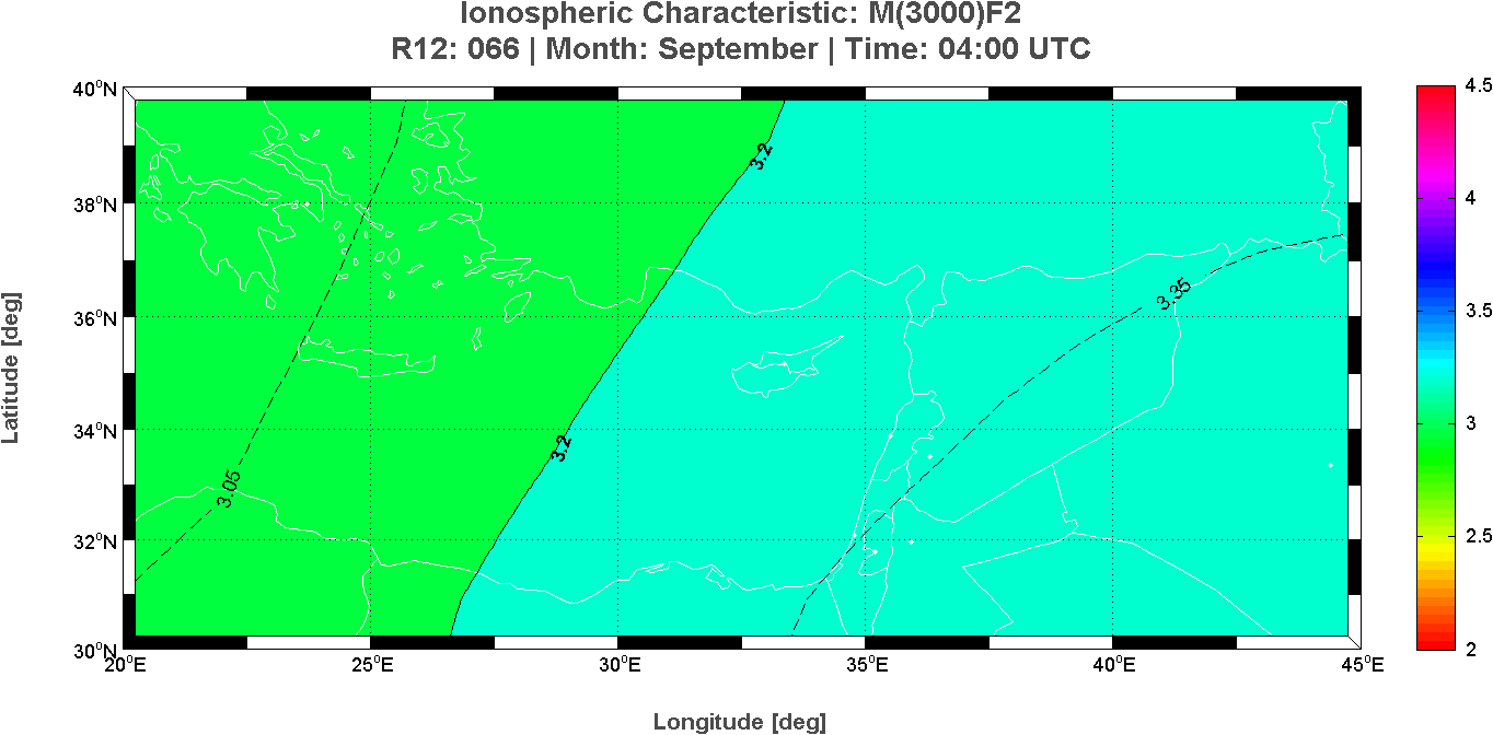
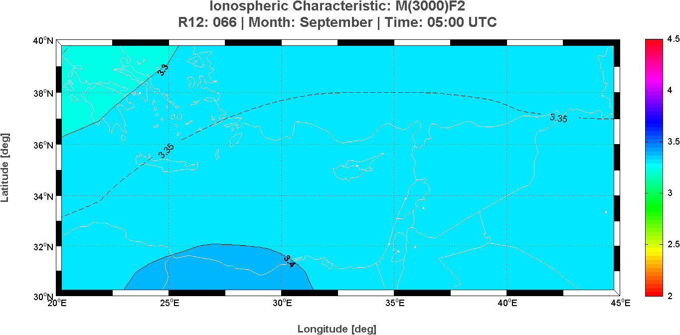
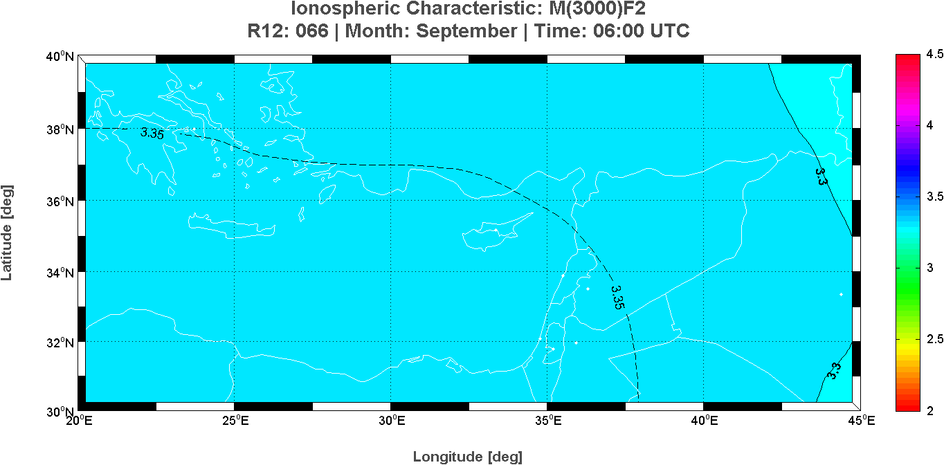
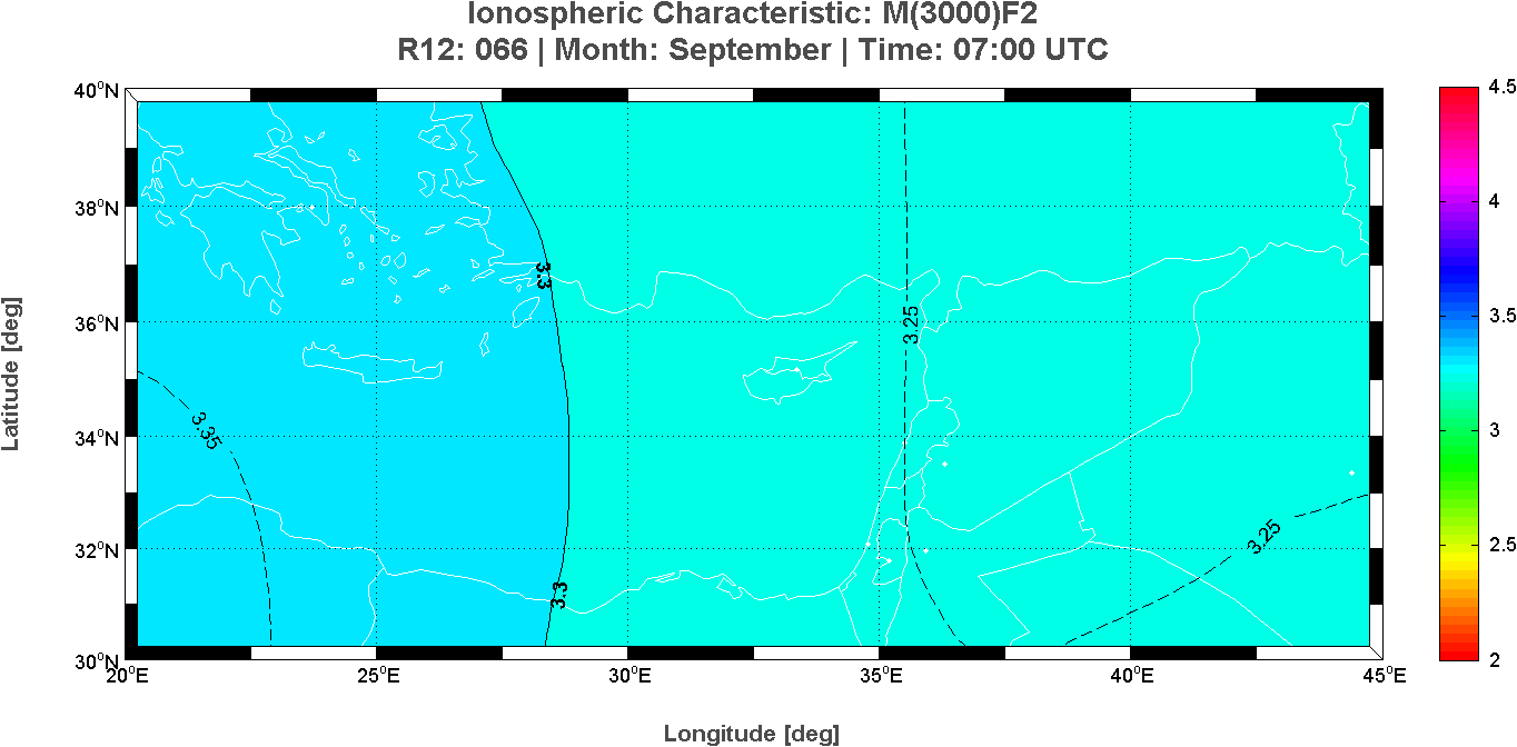
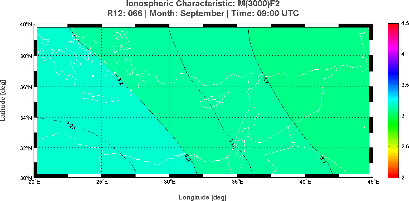
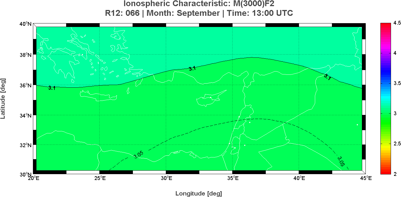
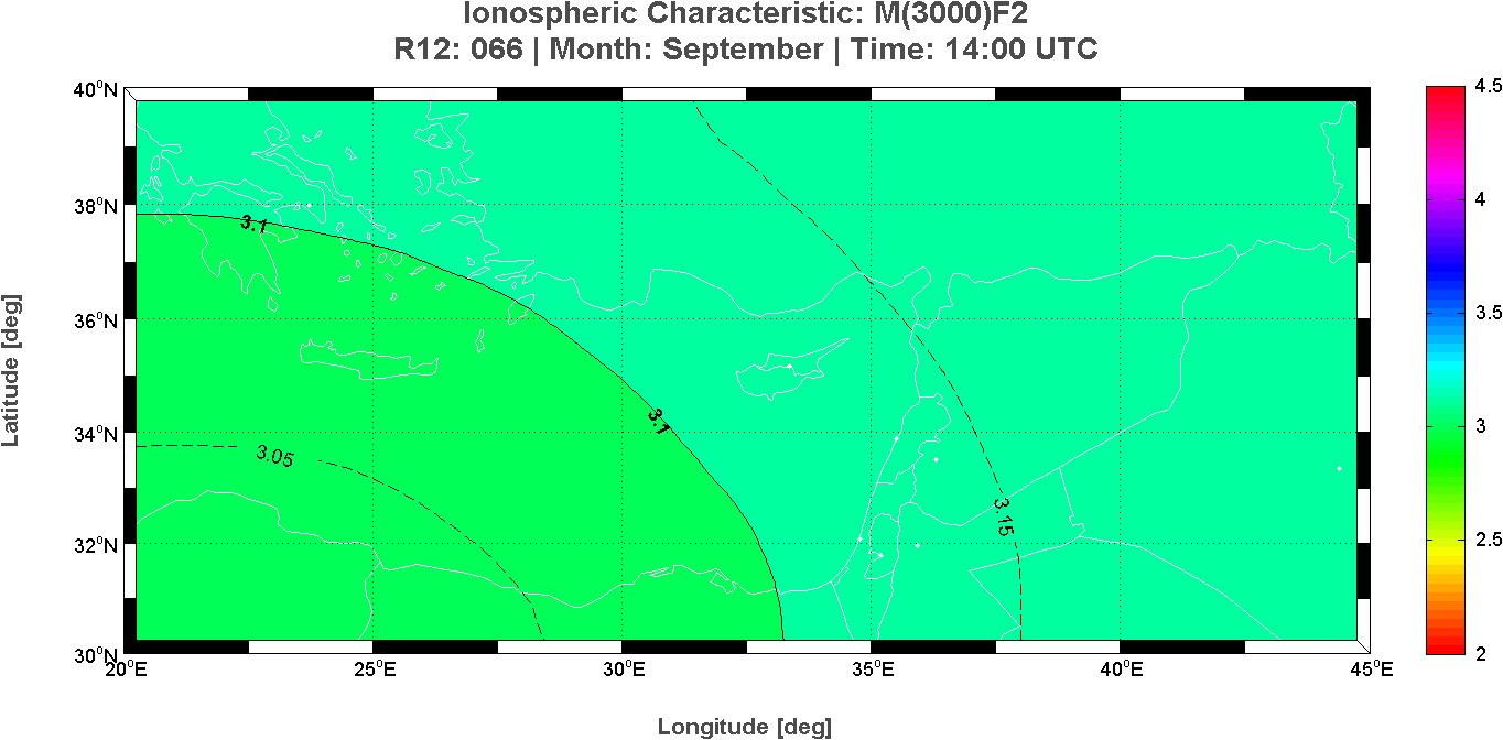
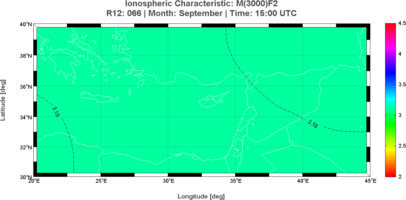
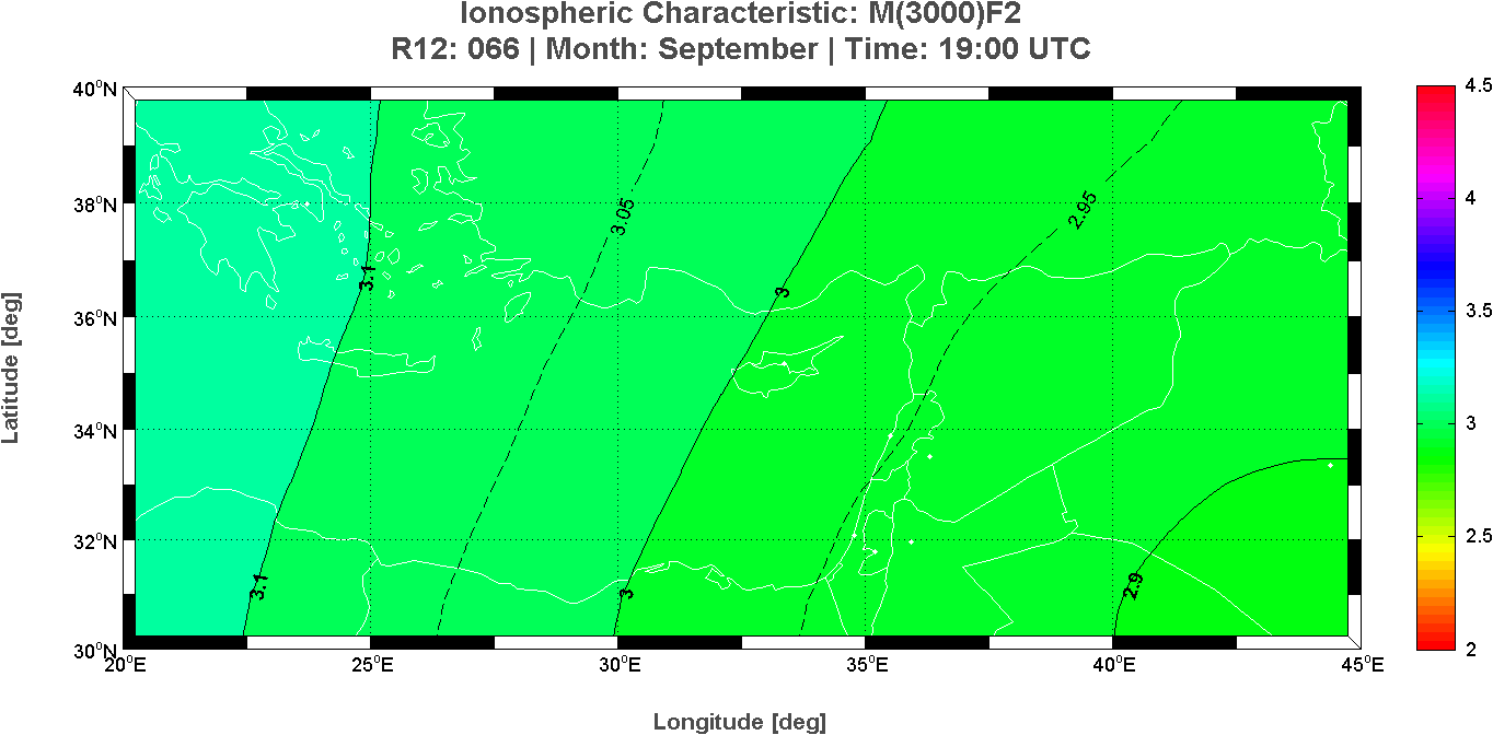
Cyprus Ionospheric Forecasting Service (CIFS) Project
Frederick Research Center, Nicosia, Cyprus
Istituto Nazionale di Geofisica e Vulcanologia, Rome, Italy
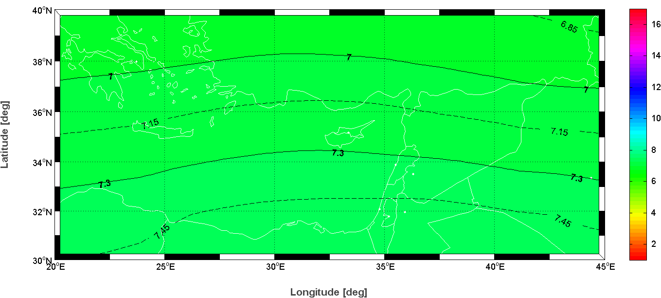
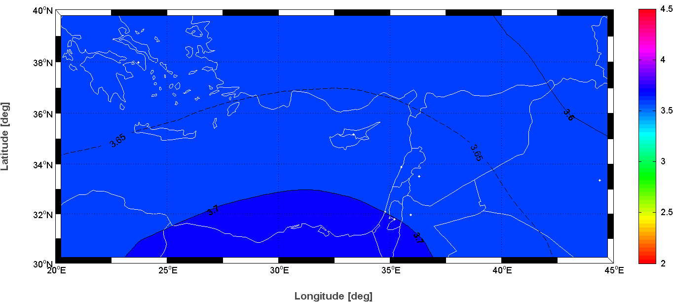
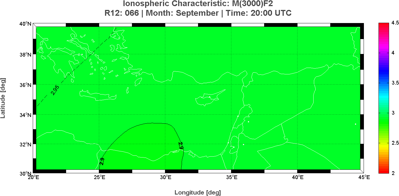
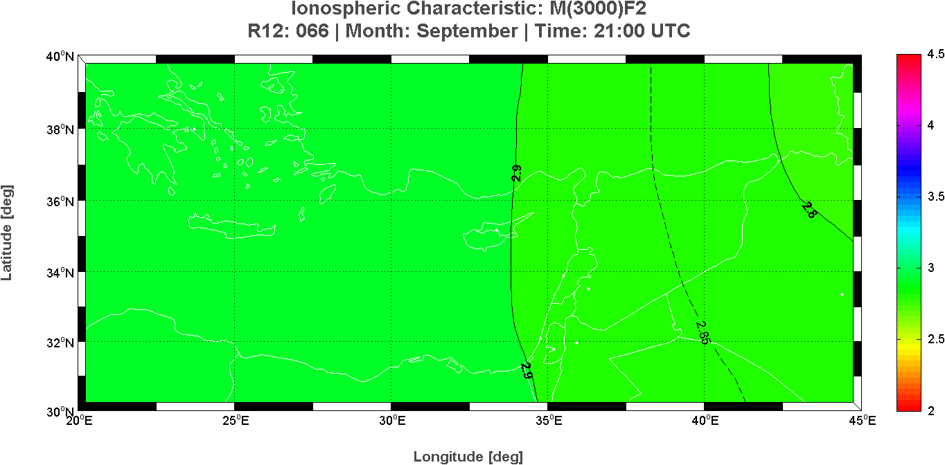
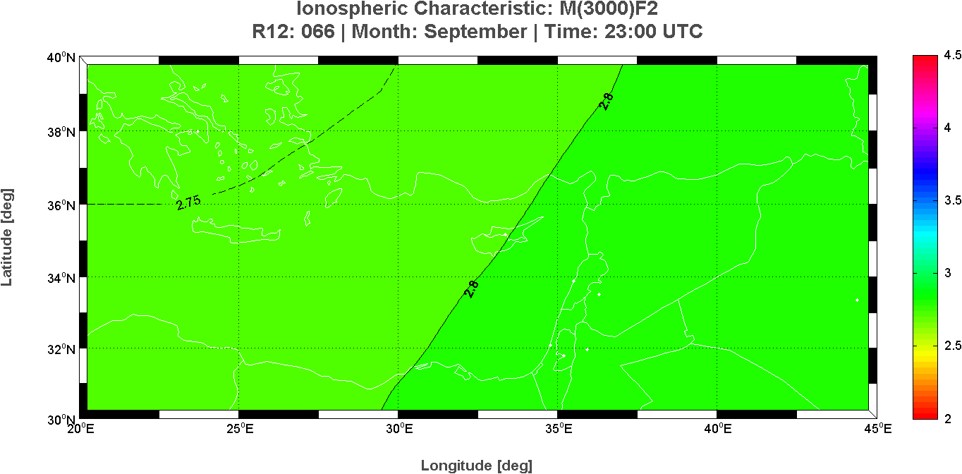
Long Term predictions maps of the ionospheric characteristic M(3000)F2
Month: September – Time: 24 hours
This page reports the 24 maps of the critical frequency M(3000)F2 calculated at each hour for the East region of the Mediterranean area. These long-term prediction maps of M(3000)F2 are derived from the Simplified Ionospheric Regional Model (SIRM).
 |
 |
 |
 |
 |
 |
 |
 |
 |
 |
 |
 |
 |
 |
 |
 |
 |
 |
 |
 |
 |
 |
 |
 |
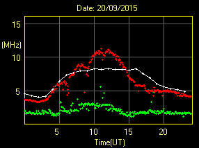
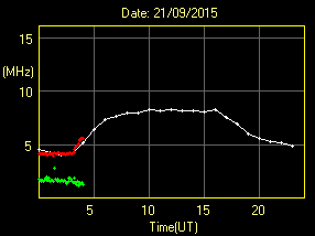
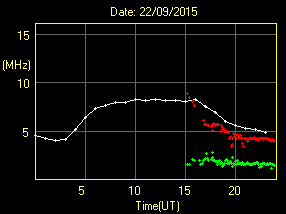
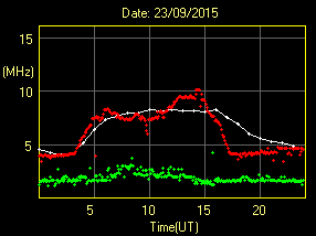
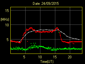
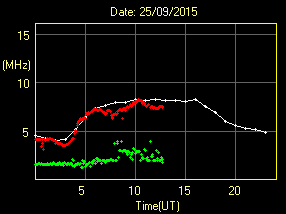
Frederick Research Center – Ionospheric Station of Nicosia – DPS4 Digisonde
foF2 and fmin plots
Latitude 35.1�N XXXX Longitude 033.2�E
This page reports the last six daily foF2 and fmin plots recorded at the Nicosia observatory by the DPS4 digisonde. The ionospheric characteristics given as output were automatically scaled by the ARTIST system. The monthly median expected values of foF2 are derived from the Simplified Ionospheric Regional Model (SIRM).
 |
||
 |
 |
 |
 |
 |
 |